But its not the only river. Several smaller rivers empty into the Thames, some covered over or diverted. One, the Westbourne, runs encased in piping across the platform at Sloane Square tube station above the heads of oblivious commuters, while others like the Fleet live on in the names of the streets whose paths intersect with the now covered over river. Both of these rivers rise in and around Hampstead Heath.
A rather larger river, London's 'other river' if you like, is the Lea. I work in the East End these days and spend a lot of time exploring the London end of this underappreciated river. Away from the tourist heavy East End of Whitechapel with its Jack the Ripper walks, Banglatown restaurants and trendy Brick Lane market, there's another East End to discover if you look beyond the obvious areas of deprivation or the Olympic Park bubble at Stratford, and one of its jewels is this river. A good way to begin exploring to use The Line. The project was established to get people walking, to enjoy the outdoors, appreciate some high quality public art, and give people the chance to see wildlife along the way. This means its hugely photogenic and a real camera magnet. Called the Line because it follows, roughly, the zero degrees meridian south from the Olympic Park to where the Lea meets the Thames, there's plenty to keep an understimulated tog, well, stimulated. Whether nature is your thing, or architecture, or people watching, here's your place to be.
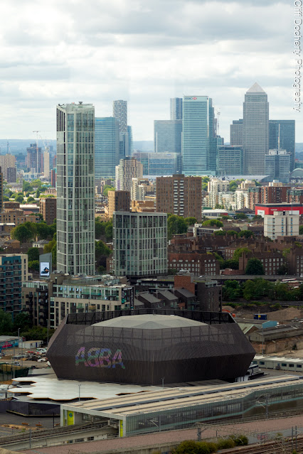
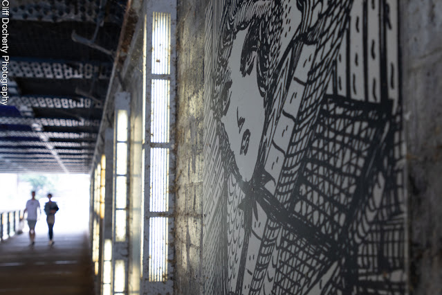
I started my walk in Stratford of course, and this time round instead of being in my usual hurry to get somewhere less redeveloped I stuck around, deciding it was high time, literally, that I climbed the Orbit and took in the views. Development is still continuing as the Olympic Park redefines itself. The V&A will soon be opening their new East London centre on the river front opposite the stadium, as will the University of East London. The nearby ABBA Arena is packing in the crowds every night while the Olympic Park itself has become a hub of community projects like the innovative Bikeworks operating out of the velodrome and the Rooftop Cinema showing open air presentations for locals and visitors alike. Standing atop the Orbit on a clear day you can see 20 miles (about 32km) though it wasn't so clear the day I went up but at nearly 400 feet off the ground it was still a pretty impressive view, with all the imaginative architecture that has sprung up since the 2012 Olympics. Its pretty much bucked the trend of most modern Olympiads, most of the permanent venues have found a use and the park remains popular, while development continues all around. The only fly in the ointment, and its a pretty elephant sized fly, is that the new housing, a large proportion of which was supposed to help alleviate the areas chronic shortage of affordable accommodation, was scaled back by the incoming London mayor just prior to the Games with the result that many of the properties went to people from outside the area or were bought as investment. The spotlight is on this now and its making people squirm, rightly so. For now, the views at least are pretty spectacular and the park is there for everyone, free to access and should you want to come down from the observation deck there's a quick way. You can fling yourself down the slide hundreds of feet to the ground. No thanks. I got the lift back down.Following the river and walking away from the park, you come to an underpass with the first of a number of Madge Gill artworks on the route. Gill was an East Ham local and has been gaining in recognition since her death in the 60's and an excellent app (details on the Line's website) can be downloaded to your phone to point out and give you the background to the various artworks you'll be ticking off from this point onward.
Crossing Stratford High Street and the Olympic torch sculpture you come down to Three Mills Island which sits between the confluence of the Rivers Lea and Channelsea which get a bit complicated at this point, splitting to become Limehouse Cut while the Lea becomes Bow Creek. But before all that happens you reach the mill that gives the island its name. Dating back to the 18th century the mill and its adjoining properties shares space with, of all things, a film studio. RuPaul's Drag Race UK has it's home here, as does Masterchef and movies like 28 Days Later. Its an attractive spot and not what you expect of the East End. The mill could've been lifted out of a Constable painting and, on a sunny day with the water pouring under the mill, and the colourful barges moored up alongside, there are worse places to be at one with the world. Do the walk in springtime and its a flower photographer's dream with wild flowers on the verges, bright splashes of yellow as daffodils vie for your attention with the waterfowl and the historic architecture.
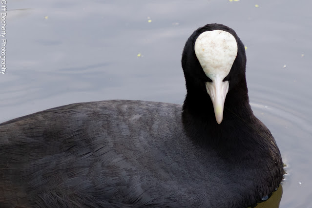
Following the river, you pass a Tracey Emin sculpture, A Moment Without You, which features a number of delicately crafted wild birds perched on top of poles. Keeping your eyes peeled at this point you will quite likely see plenty of the real thing. Herons, finches, jays, Canada geese to name a few. Bring some long lenses for wildlife shots around here, there is plenty to see. Wading birds on the mud flats and migrating birds resting in the spring and autumn. Analogue photographers will probably want to stock up on fast emulsions. Much work has been done on rewilding the river, restoring reed beds to provide nesting and refuge for water voles and all the creatures that support a healthy ecosystem. Get down there at the right time during the summer and you'll see iridescent dragonflies and damselflies looking resplendent in the sunshine as they hover over the shoreline.
Continuing downstream you reach Bow Lock and have to cross here because at this point you're on a spit of land with the river on both sides of you. Go right and you're on Limehouse Cut which will take you down to trendy Limehouse Basin, but we're going to go left and cross the bridge to the far shore and continue on the Line. Another couple of artworks await us before we reach Cody Dock with its colourful half moon bridge, the most intriguing being a sculpture made of abandoned shopping trollies with the intriguing title of DNA DL90 by Abigail Falls. Finally, at Cody Dock, a heritage project based on an old coal dock which is gradually being restored, we can stop for a coffee at their riverside café terrace before leaving the river to walk down to Star Lane DLR station and then make the turn down towards Canning Town, passing the Russian banya.
At Canning Town station we have another confusion, and its seldom difficult to confuse me. The route continues onto the Leamouth Peninsula, which you can only reach through the station, and has rather tiresomely has been 'branded' London City Island by a bunch of marketing people who really should know better. Consisting two fingers of land, pointing in opposing directions, one is an undeveloped protected piece of land which has been made into an ecological park. Bow Creek winds around it before doubling back to reach the second finger, an island bar for a tiny neck of land keeping it attached to the shore, and this one is full of designer apartments and the Royal Ballet's rehearsal rooms. Its all a bit different to how it was before the developers got hold of it, replacing a rather ugly, smelly margarine factory with highly desirable metropolitan living spaces. The peninsula had been for decades a byword for dereliction and poverty. The poorest of the poor lived there, their island home "largely cut off from outside influences … this was a closed and closely knit community, inward-looking and inbred" according to a London County Council report in the late 19th century. Or as the council's education officer at the time was moved to remark "many families have the same rather uncommon names". Quite. Finally by the 1930's the slum dwellings which covered the peninsula were cleared and some 300 intimately related residents were moved off their island paradise to less insalubrious surroundings, to be replaced by the aforementioned marge factory.
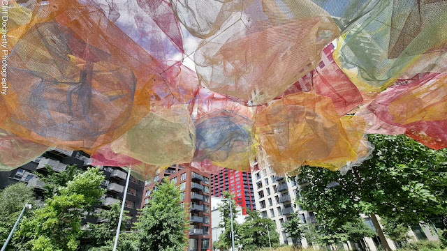
Back in the present day, the peninsula has also got a rather interesting multicoloured art installation - yes we're back on the Line - before continuing to it's extremity where you meet London's only lighthouse, a Victorian experiment sitting right on the spot where the Lea meets the Thames. And just for good measure a bright red lightship is moored next to it as if to underscore the importance of lightbulbs where water is concerned. Surrounded by artists studios in restored warehouses and shipping containers, and spectacular views of London's waterside, its one hell of a place to finish your photo walk. And if you haven't worn out your shutter finger something is amiss. More coffee? A bit of cake? Don't mind if I do.
---*---
Details of The Line can be found by following the link to their website below, where you will find info about all of the artworks and artists on the route, a useful map and a handy app which you can download to your phone. The Line
More pictures from The Line route can be seen on my main website.


Comments
Post a Comment